
resources
Explore Florida State Maps with Detailed City Information
03 Feb 2026

Considering an adventure to the Sunshine State? Florida truly offers an incredible spectrum of experiences, from the vibrant pulse of its busiest cities to the serene tranquility of its secluded beaches. Leveraging Florida state maps that highlight its cities can be extraordinarily helpful in pinpointing exactly where to go and what captivating sights await you. Indeed, whether you're meticulously planning an extensive vacation or simply a spontaneous weekend escape, a well-detailed map can make all the difference. It expertly illustrates main thoroughfares, clearly marks town locations, and even reveals some truly intriguing spots you might not have initially known about. So, let's delve deeper into just how these invaluable maps can truly enhance your exploration of Florida.
Key Takeaways
- Florida state maps with cities are great tools for planning trips, showing towns, roads, and attractions.
- You can find detailed info on cities, including their location, population, and natural surroundings.
- Interactive maps help you customize views and access data for planning and analysis.
- Florida's maps highlight different regions, from the Panhandle to South Florida's coast and the Everglades.
- These maps are useful for discovering both well-known spots and hidden gems across the state.
Navigating Florida State Maps With Cities
Understanding Florida's Geographic Layout
Florida's geographical outline is quite distinctive, presenting itself as a long peninsula gracefully extending into both the Atlantic Ocean and the Gulf of Mexico. This rather unique geography dictates that many of its principal cities are coastal, naturally benefiting from beautiful beaches and a host of maritime activities. Yet, it's certainly not all coastline; the state's interior equally boasts its own array of vital urban centers. A firm grasp of this fundamental layout is, without doubt, the initial stride toward a truly comprehensive exploration of the state.
Administratively, Florida is thoughtfully divided into 67 counties, each tasked with its specific functions. As the third most populated state in the U.S., there's an undeniable buzz of activity across its expansive landmass. Cities here vary dramatically, ranging from sprawling metropolises like Jacksonville and Miami to smaller, more specialized towns. Gaining an understanding of where these cities are situated in relation to one another, and to significant geographic features such as rivers and coastlines, helps to paint a much clearer, more nuanced picture of the entire state.
The state's geography profoundly influences everything from its climate and natural resources to its economy and the very rhythm of daily life. Coastal cities, for instance, often thrive on tourism and fishing, while inland areas might very well serve as bustling hubs for agriculture or various industries.
Key Cities and Their Locations
When one consults a map of Florida, certain cities undeniably stand out, not merely for their size but also for their considerable importance. Naturally, you'll immediately spot the major population centers:
- Jacksonville: Situated in the northeast, it proudly holds the distinction of being the largest city by both area and population.
- Miami: Found in the southeast, it's a dynamic global hub for finance, culture, and international trade.
- Tampa: Located on the west coast, this city is a significant economic center, bustling with a very active port.
- Orlando: Central Florida's undisputed entertainment capital, world-renowned for its spectacular theme parks.
- Tallahassee: The venerable state capital, strategically positioned within the Panhandle region.
Beyond these highly prominent names, Florida is home to numerous other significant cities. Locations such as St. Petersburg, Hialeah, Port St. Lucie, and Cape Coral represent substantial urban areas, each possessing its own unique character and driving economic forces. Even many of the state's smaller towns frequently boast distinctive historical or natural attractions that render them particularly noteworthy—definitely worth a closer look!
Utilizing Interactive Map Features
Modern maps, thankfully, are far from being mere static images; rather, they are incredibly dynamic and intuitive tools designed for comprehensive exploration. Interactive maps empower you to zoom in for remarkably precise, street-level detail or to zoom out, gaining a broader, more contextual view of the entire state. You can often effortlessly pan across the map, venturing into different regions without ever losing your overall orientation. Many online map services further enable you to search for specific addresses, local businesses, or various points of interest. Some of the more advanced platforms even provide customizable layers you can toggle on or off, revealing crucial information such as:
- Road networks and major highways
- Exact airport locations
- County boundaries
- Designated parks and vital natural areas
These sophisticated features undeniably simplify the process of planning trips, clarifying complex travel routes, or simply deepening your understanding of a particular locale. The ability to click on a city and instantly retrieve quick facts or view nearby attractions truly transforms a conventional map into an immensely powerful informational resource.
Exploring Florida's Diverse Urban Landscapes
Florida, as many discover, isn't solely defined by its world-famous theme parks and pristine beaches—though, admittedly, it boasts an abundance of both! The state's cities themselves offer a wonderfully broad spectrum of experiences, from the vibrant energy of bustling metropolises to the serene appeal of quiet towns, each with its own distinctive charm. Gaining an appreciation for these varied urban environments helps to paint an even richer, more comprehensive picture of the Sunshine State.
Coastal Cities and Their Attractions
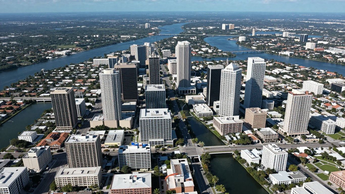
Florida's expansive coastline naturally means that many of its most celebrated cities are situated directly on the water. These coastal communities often exude a unique atmosphere, profoundly shaped by the ocean and the myriad activities it supports. Consider, for a moment, places like Miami—renowned for its iconic Art Deco architecture and the exhilarating South Beach scene—or Tampa, with its remarkably revitalized downtown and picturesque Riverwalk. Even larger cities such as Jacksonville, sometimes surprisingly overlooked for its coastal allure, proudly showcase beautiful parks and compelling attractions. These areas serve as significant hubs for tourism, offering everything from relaxing sunbathing and invigorating water sports to a vibrant nightlife and, of course, exceptionally fresh seafood.
Inland Hubs and Cultural Centers
Moving away from the immediate coast, Florida features substantial cities that function as vital cultural and economic centers. Orlando, while universally known for its world-famous theme parks, is also a rapidly growing urban area boasting a diverse population and a flourishing arts and culinary scene. Tallahassee, as the state capital, offers a noticeably different pace, characterized by its significant historical sites and governmental buildings. Cities like Gainesville, for example, are home to major universities, thereby injecting a youthful energy and a strong focus on research and education into the local fabric. These inland areas frequently provide a more grounded perspective on Floridian life, marked by strong community ties and cherished local traditions.
Smaller Towns and Unique Destinations
Beyond the prominent major cities, Florida is charmingly dotted with numerous smaller towns, each narrating its own unique story. Some, like St. Augustine, are deeply steeped in history as the oldest continuously inhabited European-established settlement in the U.S., proudly showcasing colonial architecture and historic forts. Others, such as Mount Dora, are celebrated for their enchanting downtowns replete with quaint shops and inviting restaurants, consistently drawing visitors in search of a more relaxed and artisanal experience. Then there are truly distinctive places like Weeki Wachee, famously known for its one-of-a-kind mermaid shows and refreshing natural springs, or Arcadia, a favored haunt for antique enthusiasts. These smaller communities often serve to highlight very specific facets of Florida's rich heritage or its stunning natural beauty, ultimately providing a more intimate and personal travel experience.
Florida's urban tapestry is, without question, rich and wonderfully varied. Whether your inclinations draw you to the pulsating energy of a coastal metropolis, the intriguing cultural depth of an inland hub, or the quiet, understated charm of a small town, there is undoubtedly a Florida city that perfectly aligns with your interests. Maps, in this context, are indispensable, helping us to clearly discern how these diverse places connect and what precisely makes each one so inherently special.
Here's a look at some types of cities you'll find:
- Coastal Cities: Often centers for tourism, water activities, and vibrant nightlife.
- Inland Hubs: Typically serve as economic, educational, or governmental centers, with strong local communities.
- Historic Towns: Preserve the state's past through architecture, museums, and cultural sites.
- Unique Destinations: Known for specific attractions, natural features, or local traditions.
Detailed Information for Florida Cities
When you're perusing Florida maps, it's quite easy to become absorbed by the broader picture, but often, the true essence of a place lies within the intricate details of each individual city. Gaining a comprehensive understanding of what makes each locale truly distinctive involves examining a few critical areas. We're talking, of course, about the foundational elements—the core geographic facts, how the city is governed, the demographic makeup of its residents, and the surrounding natural resources that shape its character.
Geographic and Administrative Data
Every city occupies its particular spot on the map and operates under its own distinct system of governance. This encompasses crucial information such as its precise location, defined boundaries, and the specific county to which it belongs. For instance, knowing whether a city is coastal or inland can reveal a great deal about its potential for tourism or industrial development. Similarly, administrative data elucidates its legal standing and how its daily operations are managed.
Here's a glimpse at some fundamental data points you might encounter:
- County: The administrative division the city falls under.
- Elevation: The average height above sea level, which can affect things like flood risk.
- Land Area: The total size of the city in square miles.
- Incorporation Date: When the city officially became a municipality.
Grasping these fundamental facts represents the initial—and crucial—step toward genuinely getting acquainted with a place. It's much like learning someone's name and where they reside before truly engaging in a meaningful conversation.
Population and Development Insights
The demographic composition of a city and its trajectory of growth tell a significant portion of its evolving story. Population figures offer a sense of scale, allowing us to differentiate between bustling metropolises and quieter, more intimate communities. Insights into development, such as prevailing building trends or specific economic activities, provide a clear indication of the city's future direction. For example, a city experiencing a burgeoning population is often found investing heavily in new infrastructure to support its expansion.
| City Name | Population (2024 Estimate) | Growth Rate (%) | Major Industries |
|---|---|---|---|
| Miami | 467,963 | 1.2 | Tourism, Finance, Trade |
| Orlando | 316,020 | 1.8 | Tourism, Technology |
| Jacksonville | 971,318 | 0.9 | Logistics, Healthcare |
While these figures are naturally subject to change, they offer a valuable snapshot of a city's current vitality. It's quite interesting to observe how dynamic places like Miami, Florida, for example, function as significant international business hubs, boasting incredibly diverse populations.
Natural Resources and Environmental Data
Florida is undeniably blessed with an abundance of unique natural features, and appreciating these is absolutely central to understanding its cities. This specific data encompasses elements such as primary water sources, the proximity of nearby parks, or critical environmental considerations. For cities located near the coast, an understanding of sea levels and prevalent storm patterns becomes paramount. Inland cities, by contrast, might place a greater emphasis on agricultural resources or their invaluable freshwater springs.
Key environmental aspects warranting consideration include:
- Waterways: Proximity to rivers, lakes, or the expansive ocean.
- Protected Areas: Nearby state or national parks, wildlife refuges.
- Environmental Concerns: Potential issues like water quality, air pollution, or coastal erosion.
- Natural Resources: Availability of resources like fertile land for agriculture or unique geological formations.
Florida Transportation and City Connectivity
Navigating Florida and truly understanding how its various cities are interconnected is, without question, fundamental to exploring the Sunshine State effectively. The state benefits from a remarkably well-developed network, which considerably simplifies travel between its numerous urban centers and celebrated attractions.
Major Highways and Road Networks
Florida's highway system is impressively extensive, meticulously designed to link its major cities and most popular destinations. The Florida Department of Transportation (FDOT) diligently maintains a comprehensive map that clearly delineates these crucial routes. You'll readily find major interstates such as I-4, which neatly bisects the center of the state, connecting bustling Tampa and Orlando, and I-10, gracefully running east-west through the Panhandle. State roads and U.S. highways adeptly fill in any gaps, providing essential access to smaller towns and specific points of interest. Planning a road trip here is typically a straightforward affair, thanks to clear signage and a generally well-maintained infrastructure.
Here are some of the main arteries you'll likely encounter:
- Interstate 95 (I-95): Runs along the Atlantic coast, connecting cities like Jacksonville, Daytona Beach, and Miami.
- Interstate 75 (I-75): Travels north-south through the center of the state, passing through cities like Gainesville, Tampa, and Naples.
- Interstate 4 (I-4): A vital east-west connector in Central Florida, linking Tampa and Orlando.
- U.S. Route 1 (US-1): Follows the eastern coastline, offering a more scenic route through many smaller towns.
- U.S. Route 41 (US-41): Runs north-south through the western part of the state, passing through cities like Tampa and Fort Myers.
Airports and Travel Hubs
For covering longer distances or requiring quicker travel, Florida's airports serve as significant and efficient hubs. Major international airports are strategically located in cities like Miami (MIA), Orlando (MCO), Tampa (TPA), and Fort Lauderdale (FLL), collectively processing millions of passengers annually. These airports function as crucial gateways, not just for international visitors but also for domestic travelers connecting to various parts of the state. Beyond these prominent international gateways, numerous regional airports and smaller airfields cater to general aviation and specific local needs, further strengthening the state's overall connectivity—truly knitting the state together seamlessly.
Some of the busiest airports include:
- Miami International Airport (MIA): A major hub for international and domestic flights, especially to Latin America and the Caribbean.
- Orlando International Airport (MCO): Serves the massive tourism industry in Central Florida, with direct flights to many global destinations.
- Tampa International Airport (TPA): A key airport for the west coast of Florida, connecting travelers to business and leisure destinations.
- Fort Lauderdale-Hollywood International Airport (FLL): Another significant gateway for South Florida, popular with both domestic and international visitors.
- Jacksonville International Airport (JAX): The primary airport for Northeast Florida.
Mapping Tourist Information
When you consult Florida maps, you'll frequently discover that tourist-oriented information is often integrated directly into the display. This can encompass the precise locations of beloved theme parks, stunning beaches, various state parks, significant historical sites, and even major hotels or convention centers. Interactive maps, thoughtfully provided by the state itself or by dedicated tourism boards, typically allow you to meticulously filter information based on your particular interests. This capability greatly simplifies the process of planning your itinerary, whether your goal is to find family-friendly attractions in Orlando, experience the vibrant nightlife of Miami, or immerse yourself in the natural beauty of the Everglades. These comprehensively integrated maps are incredibly useful for anyone planning a trip, proving invaluable for visualizing distances and the proximity between various attractions.
Understanding Florida's intricate transportation network and how its cities are linked goes far beyond merely knowing road names. It involves grasping the dynamic flow of people and goods, appreciating the accessibility of diverse regions, and recognizing the overarching infrastructure that robustly supports Florida's varied economy and distinctive lifestyle. Whether you're driving, taking a flight, or simply studying a map, this inherent connectivity profoundly shapes the entire experience of exploring the state.
Leveraging Florida City Maps for Planning
Tools for Customization and Analysis
As you begin to explore Florida's cities on a map, you'll quickly realize there are some remarkably useful tools available to help you genuinely delve into the details. Picture it almost like possessing a super-powered magnifying glass specifically for the state! You can often fine-tune what you see, perhaps by highlighting only the charming coastal towns or, conversely, concentrating on areas abundant with natural springs. This capability allows you to perfectly tailor the map to whatever specific query you're trying to resolve, whether that involves meticulously planning an epic road trip or simply investigating potential locations for new developments.
Furthermore, these tools aren't just for passive viewing. Many advanced map services empower you to measure distances, meticulously draw out routes, or even add your own personalized notes. This functionality is incredibly handy if you're attempting to calculate precise travel times between cities or to clearly mark specific spots you're eager to visit. The ability to customize the map's view unquestionably renders it far more potent and useful than a mere static picture.
Accessing GIS Data Archives
Beyond the interactive maps themselves, there exists an entire realm of raw, comprehensive data, readily available if you know exactly where to look. Geographic Information System (GIS) data archives function much like extensive libraries, brimming with highly detailed information about Florida's intricate geography. This treasure trove can include elements such as precise property boundaries, detailed elevation data, or even the exact locations of various types of natural resources. For professionals working in urban development, environmental science, or even just particularly curious citizens, this data proves to be incredibly informative and insightful.
Here's a brief look at some of the valuable information you might uncover:
- City Boundaries: Precise outlines of incorporated city limits.
- Land Use Data: Information on what different areas are zoned for (residential, commercial, agricultural, etc.).
- Environmental Features: Locations of wetlands, forests, or protected habitats.
- Infrastructure Details: Data on roads, water systems, and power grids.
Such detailed information is often freely accessible and can be seamlessly combined with other datasets to construct a truly complete and nuanced picture of any specific area.
Integrating Map Data with Other Resources
What truly elevates the power of Florida's city maps is their remarkable ability to be seamlessly connected with other information sources. Imagine, for a moment, examining a city map and then overlaying data showcasing its population growth over the past decade, or immediately seeing where major employers are concentrated. This level of sophisticated integration helps you to grasp the larger narrative unfolding behind the raw geography.
For instance, urban planners might combine city map data with census information to precisely visualize population density across different neighborhoods. Developers could scrutinize parcel data alongside detailed zoning maps to accurately identify prime potential building sites. Even for personal travel, you could readily link map data with restaurant reviews or local event listings to plan your itinerary far more effectively and with greater insight.
The true benefit genuinely emerges when you cease to perceive the map as merely a diagram and begin to employ it as a dynamic instrument to connect disparate pieces of information. It adeptly helps you to discern patterns and relationships you might otherwise overlook, rendering your planning endeavors significantly more informed and ultimately, more effective.
This comprehensive approach enables a much deeper, more granular analysis, moving well beyond simple location finding to foster a far more nuanced understanding of how various factors interact within Florida's diverse urban environments.
Discovering Florida's Regions Through Maps
North Florida's Panhandle and Capital
Florida's Panhandle extends westward, much like a welcoming arm. This distinct area is widely celebrated for its breathtaking white-sand beaches along the Gulf Coast and its rather traditional Southern charm. Cities like Pensacola and Tallahassee, the esteemed state capital, firmly anchor this captivating region. Tallahassee, in particular, offers a fascinating glimpse into Florida's rich history and governmental workings, featuring its historic capitol building and numerous engaging museums. Maps are indispensable here, enabling you to trace the intricate coastline, pinpoint popular beach towns, or accurately locate the many state parks and pristine natural areas thoughtfully scattered throughout the region.
Central Florida's Attractions and Springs
Central Florida is, perhaps, most commonly regarded as the theme park capital of the entire world, with Orlando alone attracting millions of visitors. Yet, beyond its prominent manufactured attractions, this region is delightfully dotted with natural springs—many of which are wonderfully crystal clear and absolutely perfect for a refreshing dip. Areas such as the Ocala National Forest are meticulously mapped out, featuring well-defined trails for hiking and precise locations of these natural swimming holes. Truly, comprehending the close proximity of these natural wonders to the bustling tourist hubs can greatly assist in planning a trip that gracefully balances manufactured excitement with undeniable natural beauty.
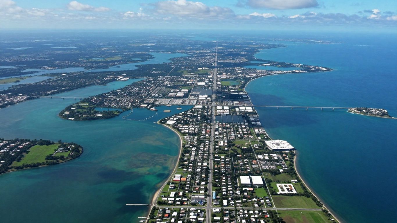
South Florida's Coastal and Everglades Areas
Journeying down to South Florida, you'll encounter a distinctly different atmosphere altogether. The Atlantic coast proudly hosts vibrant cities like Miami, famously known for its iconic Art Deco architecture and vivacious atmosphere, while the Gulf coast boasts charming areas like Naples, which offers a decidedly more relaxed, upscale experience. Further inland, the immense Everglades National Park presents an absolutely unique ecosystem of sprawling wetlands and diverse wildlife. Maps here are truly indispensable for grasping the expansive nature of the Everglades, effectively identifying access points, and accurately locating visitor centers. The Florida Keys, a picturesque chain of islands gracefully stretching south, also represent a key feature—renowned for their rich marine life and unique island culture, all clearly and beautifully laid out on detailed maps.
Wrapping Up Your Florida Map Exploration
So, we've journeyed through the intricate world of Florida maps, examining the myriad cities they so clearly depict. From the bustling, sun-drenched beaches of Miami to the quieter, more contemplative spots nestled inland, there's truly an incredible amount to experience. Whether your purpose is meticulously planning a trip, contributing to a professional project, or simply satisfying a casual curiosity about the state, these maps consistently provide an excellent framework for navigation. They adeptly illustrate geographical positions, ranging from major metropolitan centers to charming smaller towns, and can undoubtedly help you uncover new, fascinating locales you might not have otherwise known existed. Keep exploring, and you'll undoubtedly discover all sorts of intriguing spots across the remarkable Sunshine State.
Frequently Asked Questions
What kind of information can I find on Florida maps?
Florida maps offer a wealth of details about its cities and towns. You can readily discern their geographical positions, learn about their population sizes, and even gain insights into the communities residing there. Furthermore, these maps highlight essential roads, airports, and picturesque natural attractions like beaches and invigorating springs.
Are there maps that show both big cities and small towns in Florida?
Absolutely! Florida maps are quite comprehensive, covering all varieties of locales. You'll certainly find extensive information on major cities such as Miami and Orlando, as well as on countless smaller, unique towns that possess their own distinctive charm—think Weeki Wachee with its famous mermaid shows or Arcadia, which is celebrated for its antique shops.
How can maps help me plan a trip to Florida?
Maps are incredibly instrumental for effective trip planning. You can utilize them to pinpoint attractions near your starting point, discover hidden local gems, identify optimal locations for activities like camping or dining, and efficiently plot the most convenient routes for travel, whether by utilizing major highways or accessing airports.
What are some of the main cities mentioned in Florida maps?
Florida is home to many prominent and well-recognized cities. Among the largest and most frequently visited are Miami, Jacksonville, Tampa, Orlando, and the state's capital city, Tallahassee. Maps typically feature these cities and numerous others, offering a comprehensive overview of Florida's geographical layout.
Can I find information about Florida's natural resources on maps?
Certainly! Maps are excellent resources for locating Florida's stunning coastlines, its renowned springs, and significant natural areas such as the vast Everglades. This information is particularly valuable for understanding the state's diverse environment and planning engaging outdoor adventures.
Where can I find interactive maps of Florida cities?
Many online platforms provide excellent interactive maps of Florida cities. These typically incorporate tools that enable you to zoom in, explore different regions, and often even customize the map to suit your specific needs. The Florida Department of Transportation, for instance, is a great source for detailed transportation maps.


